

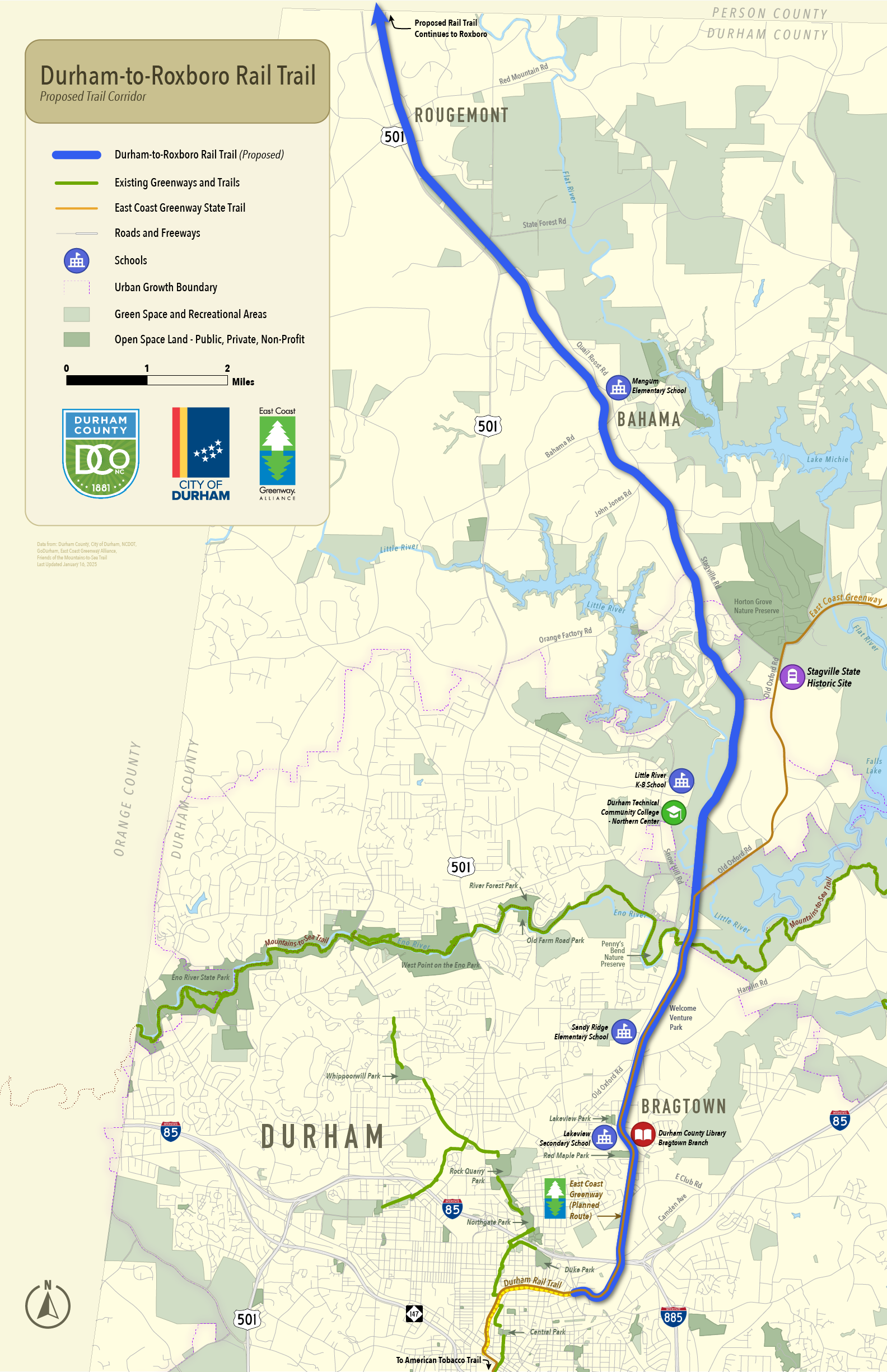
Evaluating the potential to transform 18 miles of unused rail line in Durham County into an iconic trail that celebrates history, preserves the environment, and enhances community well-being.
Durham-to-Roxboro Rail Trail Planning Study
About
The project is a collaborative effort led by five key organizations: Durham County, Triangle West Transportation Planning Organization (TWTPO), City of Durham Parks and Recreation, North Carolina Department of Transportation (NCDOT), and East Coast Greenway Alliance.
Through robust public engagement and input, the planning study seeks to honor the area’s rich history while designing a distinctive rail trail experience that celebrates and protects the unique environment, heritage, and character of the corridor.
To learn more about the project history, timeline, funding and other information, please see the Frequently Asked Questions (FAQ).
PROJECT UPDATE
View the presentation of community input and draft trail concepts presented at the October 6 Board of County Commissioners meeting. Visit the BOCC Agendas & Library for the meeting recording.
Explore community input and map comments from Phase 2 using our interactive tool.
Read all original public comments (with personal information removed) for full transparency.
View the conceptual designs being considered for the rail trail including trailheads, trail connections, and overall trail design. To provide comments on the conceptual designs, please complete the draft recommendations public survey.
View the presentation of community input and draft trail concepts presented at the April 7 Board of County Commissioners meeting. Visit the BOCC Agendas & Library for the meeting recording.
Explore community input and map comments from Phase 1 using our interactive tool.
Read all original public comments (with personal information removed) for full transparency.
“The Durham-to-Roxboro Rail Trail Plan is about more than just a trail—it’s about bringing our community together, honoring Durham’s history, and building a lasting legacy for future generations.”
~ Durham County Commissioner Burton
Plan Goals

ASSETS

PARTNERS

CONNECTIVITY

UNITY

VISUAL

STRATEGY
"The Durham-to-Roxboro Rail Trail represents an incredible opportunity to bring people together, promote healthy outdoor activity, enhance our city’s vibrancy, connect to our unique history, provide an integral bicycle and pedestrian corridor for our City's active transportation network, and inspire pride in the unique character of Durham."
~ City of Durham Councilmember Rist
Plan Process
1) Research and Preliminary Analysis (October 2024 –March 2025)
2) Trail Visioning and Public Engagement (January – April 2025)
3) Concept Plan and Public Engagement (April – August 2025)
4) Final Plan Development (August – October 2025)
Project Partners

Project Management Team:

Project Advisory Committee:

Trail Identity Committee:

Community Members:
Person County Trail Feasibility Study
The proposed rail trail would ultimately establish a 26-mile trail network linking downtown Durham to Roxboro. See the Person County Trail Feasibility Study here.
To get updates about the Durham-to-Roxboro Rail Trail Plan, enter your name and email below.
Project Contacts:
David Miller
Transportation Planner
Triangle West Transportation Planning Organization (TWTPO)
(919) 503-4118
[email protected]